Earth Observation Technology
Luxembourg Start-up Innovates to Reduce Climate Risk
We are in an era of interconnectivity and interoperability where the
need for reliable and usable geospatial information is rapidly increasing.
This data is particularly useful in the face of increasing extreme weather events. A few organisations, both national and international, are developing targeted products and services to meet this demand. RSS-Hydro, a Luxembourg-based R&D start-up, is part of this landscape and is developing products and services dedicated more specifically to water-related risks.
In general, EO algorithms, and in particular flood models, are computationally intensive. Thanks to advances in computational and geospatial technologies, which are developing at an unprecedented pace, an ever-increasing volume of data is being rapidly processed for decision making. Mutually beneficial public-private partnerships are sometimes established. For instance, RSS-Hydro has recently joined forces with the Luxembourg Institute of Science and Technology (LIST) and the leading Italian IT company Fadeout Software to create a joint venture called WASDI. It offers a fully interoperable platform, on which users can develop and execute EO-based apps for a variety of applications, including disaster assistance tools such as global flood mapping and fire detection from satellites. This solution offers an interesting potential in the face of increasing climate risks. The insurance industry has understood this and is one of the first users employing this platform as well as the patented HASARD flood mapping app, developed by LIST, to help trigger flood insurance payouts in several countries in southeast Asia.
Technology is being pushed further and further to produce accurate and comprehensive maps for decision making in the face of increasingly frequent weather events. Given the high demand from industry sectors as well as the humanitarian and aid development community to offer more innovation in the EO application market, the WASDI platform allows businesses to scale up more rapidly by using more efficient computing resources, optimizing mapping algorithms and unlocking the full potential of big geospatial datasets. With the support of the European Space Agency (ESA) and the Luxembourg Space Agency (LSA), RSS-Hydro is, for example, developing an application that uses a machine learning model to reconstruct flooded areas under partial cloud cover in optical satellite images. Once deployed on the WASDI platform, this app, called FloodSENS, would provide decision-makers with a lot more flood maps than currently possible from the many optical satellite missions that now exist.
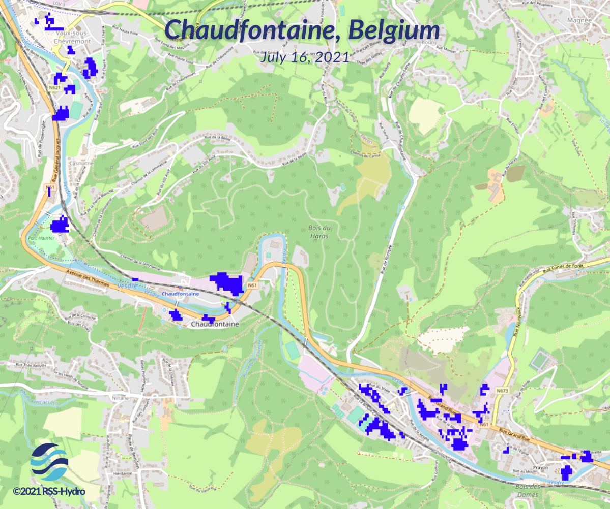
Map showing flooded buildings in Chaudfontaine, a village (Belgium), during the devastating floods in summer 2021. It has been created on the WASDI platform by processing Copernicus Sentinel-1 satellite radar images with the urban flood mapping algorithm developed by LIST.
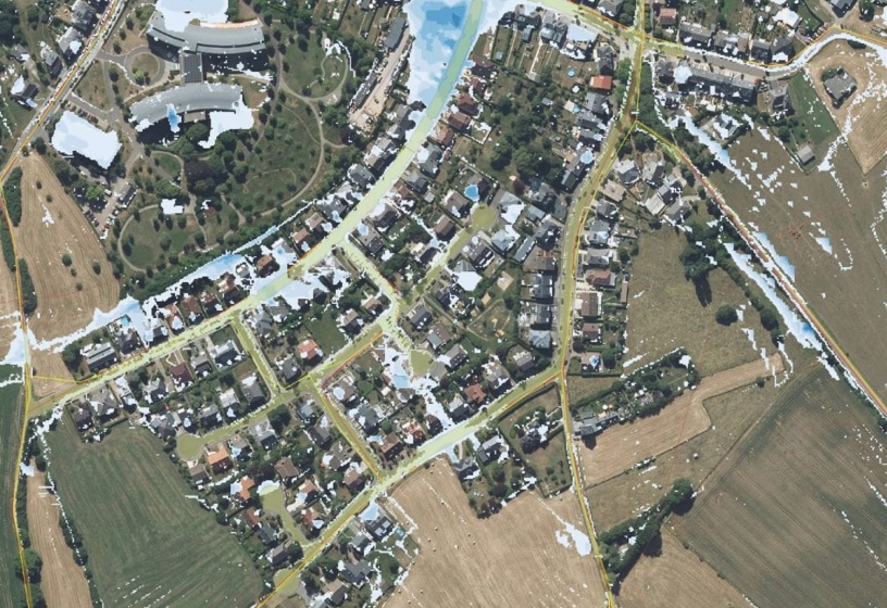
The young start-up offers high resolution flood depth maps by integrating Earth Observation (EO) data with flood model simulation to assess the impacts of climate change. Very high precision drone images are analyzed to complement and validate those mapping efforts. For instance, RSS-Hydro used this expertise and knowledge to showcase actionable maps during the devastating Europe summer floods of this year.
Although such maps are commonly produced by the industry sector for commercial purposes, this information can also be used pro-actively in the humanitarian and aid development sector. For example, RSS-Hydro is part of the United Nations World Food Programme (UN WFP) Drones technical working group. Dr. Guy Schumann, founder of RSS Hydro regularly assists the UN WFP emergency operations with expert advice during flood disasters around the globe. The company is also starting a development project with a partner institution in Niger where it uses its EO model and technologies to increase resilience of society in the face of hydro-meteorological disasters in the Sahel region.