Resilience from the Sky?
From Leonardo da Vinci to the Montgolfier brothers, many people, nourished by immemorial fantasies, have wanted to defy the laws of gravity. Man's most ancestral dream, to fly, has no longer been a utopia for several decades. Flying machines have evolved, but some of them have particularly the wind in their sails in recent years: drones. There are now more than 10 million of these technological gems in the world, crisscrossing our skies. From sustainable agriculture to health care or efficient logistics, many of their recent applications are very promising and make them an essential tool for resilience. However, their mass introduction is not without its share of questions and limitations. Between opportunities and potential drifts, let’s explore this unindentified flying object.
Make no mistake, these roaring machines have been studied since the beginning of the 20th century. The conceptualisation of the first unmanned aerial vehicles (UAV) dates back to July 2nd, 1917, when Max Boucher, Captain of the French aviation school, using an automatic pilot system, programmed the take-off of the first drone in history at the Avord military base. At the same time, in the United States, engineers were working on projects for radio-controlled aircraft, mainly for military use, which were equipped with an air torpedo system. The use of these remote-controlled aircrafts then multiplied within the ranks of the US Army to carry out surveillance operations in enemy territory, particularly during the Vietnam War. The system is elementary: the machine, equipped with four rotors powered by an electric motor, is fitted with an on-board camera for low altitude shots. Its assets are: hovering flight, offset and vertical landing. It was only later, in the 1930s, that the name drone appeared in Great Britain. Meaning "Male bee", it was chosen by analogy with the humming and slowness of the first aircraft.
Precious medical and sanitary tool
It is in emergency situations and natural disasters, when distance and time become enemies, that drones and all their potential come into play. Their use in the medical field is organised more rapidly than anywhere else. For example, to intervene as quickly as possible by transporting products to places where the state of the roads and the terrain makes land transport long, costly, and dangerous. The drone ambulance, for example, with a cruising speed of 100 km/h, can transport a defibrillator in one minute in a 12 km2 area, increasing the patient's chances of survival from 8 to 80%.
Recently, faced with the Covid pandemic, many of these possibilities have come to light. In Europe, several countries have chosen this technology to order those refractories to containment measures to return home. In China, companies such as Baidu have equipped UAV units with infrared cameras, coupled with facial recognition, that can measure the body heat of 15 people at the same time, within 0.3°C, and sound an alarm in case of fever. All this is done to place people at risk in quarantine as quickly as possible or to redirect them to health services able to take care of them.
Other countries such as the United Kingdom, Scotland and the United States have also adopted these tools to be able to deliver many medical equipment and materials to hospitals or isolated communities. In the United States, these initiatives have been made possible through the partnership between CVS Health Corporation and the retail giant UPS. This solution offers key benefits during a pandemic, such as speed of delivery, social distancing and protection of healthcare workers.
In Seoul (South Korea), the authorities were especially creative. With more than 300 drones illuminating the sky, they created an extraordinary show that reminded the population of security measures and, at the same time, encouraged the medical staff. This ten-minutes illumination show was relayed around the world on July 4, 2020.
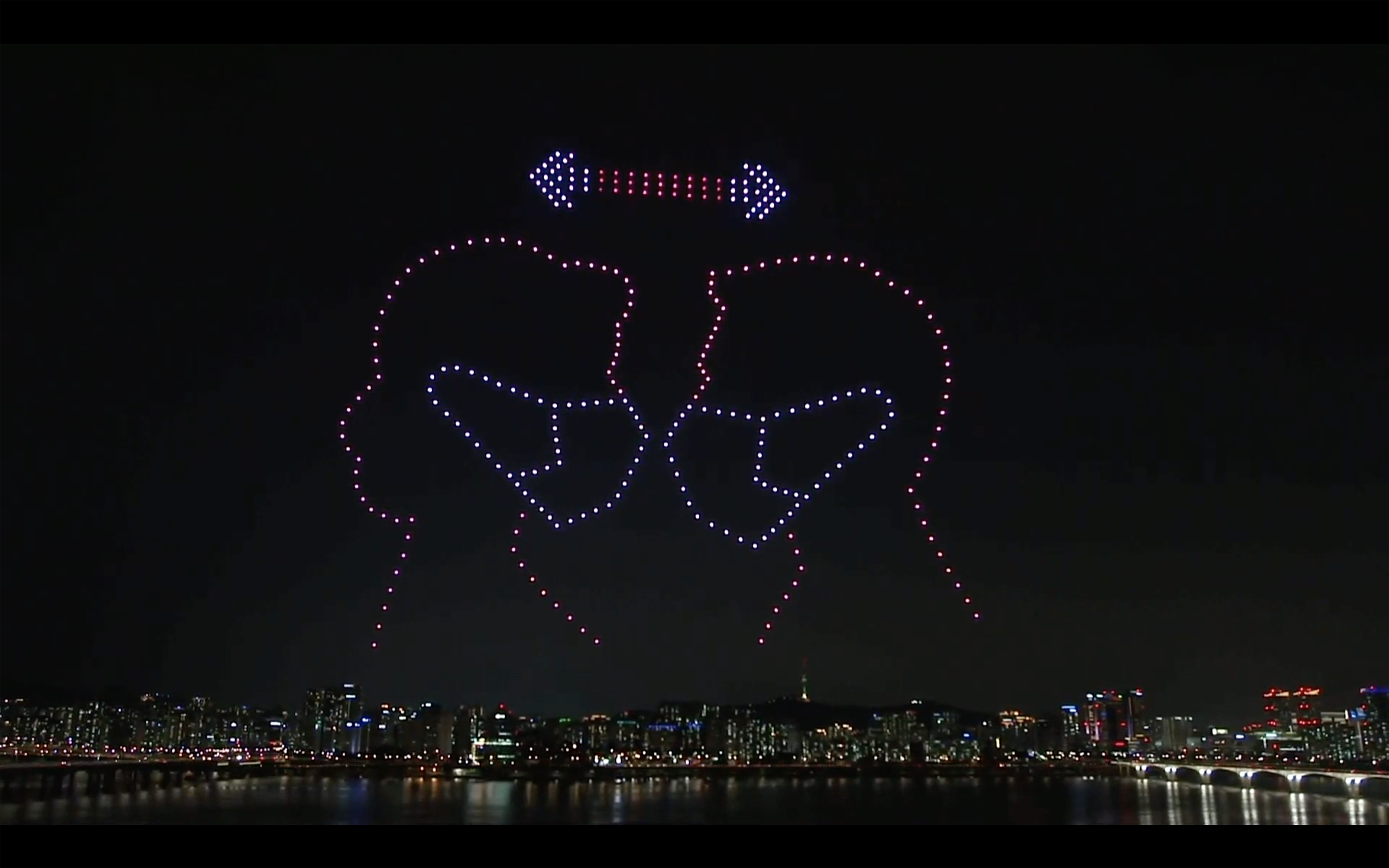
Organised by the Ministry of Land, Infrastructure and Transport, to thank health workers and raise awareness about social distancing, 300 drones performed a light show of ten minutes, in Seoul, on the 4th of July.
In the past, drones have proven themselves. Since 2012, following the earthquake in Haiti, hundreds of first aid kits were delivered by air. Also, in Papua New Guinea, the organisation Médecins Sans Frontières set up an innovative operation in 2014 to help reduce the difficulties of access to isolated communities. The objective of this mission was to transport saliva samples from patients suspected of having tuberculosis, medical results, and treatments. Not only that, since 2016, the city of Bangalore in India has been running a project to transport organs by drone since 2016. This project has made it possible to reduce by more than 50% the delivery time of organs intended for transplantation, a crucial reduction of time to save more lives.
The public health stakes are considerable, especially on the African continent, where many patients suffer from the lack of health products, caused by the poor state of roads and the inaccessibility of some villages. In collaboration with the government, the American start-up ZipLine has been able to implement in Rwanda a sustainable solution for transporting medicines and blood bags to isolated areas. 7,000 bags have already been delivered thanks to no less than 4,000 flights. The drones used have a range of 120 km, a weight of 12 kg, and can transport 1.3 kg packages. The enthusiasm for this technology is such, that a first "Droneport" should be built in 2030 in Rwanda, in the hope of rationalising and industrialising the transport of health products more quickly and at a lower cost.
This Droneport has two different transport lines: blue and red. The Redline UAV, used for health missions, has a three-metre wingspan and can transport 10 kilograms of equipment over a distance of 50 kilometres at 100 km/h. In contrast, the Blueline UAV, dedicated to commercial missions, has a six-metre wingspan and is able to move a 100 kg load over 100 km.
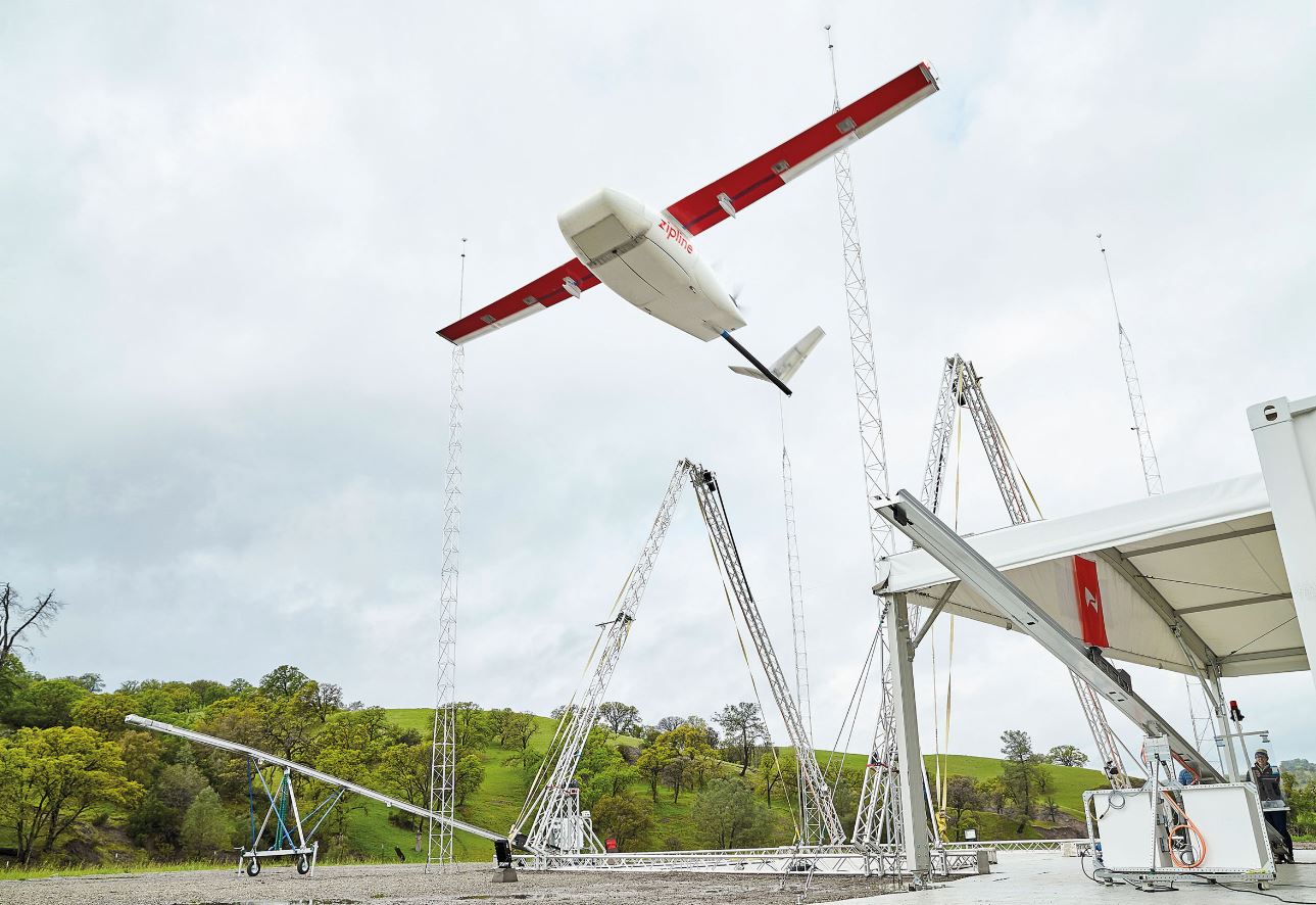
A drone launches from Zipline’s California-based test facility.
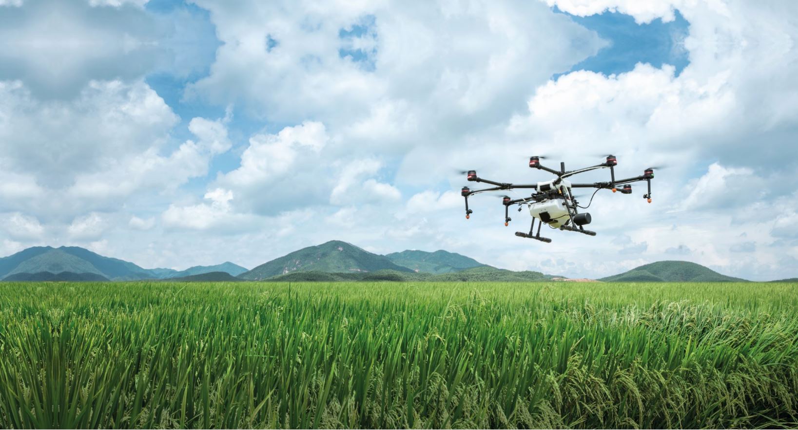
Toward precision agriculture (PA)
Some believe that the agriculture sector would represent the most significant potential financial windfall from the use of UAVs. According to PWC forecasting studies, the market for commercial UAVs in agriculture could generate $32.4 billion in the international economic activity. In the fight against climate change and the challenge of food insecurity increased by a rapid population growth, some farmers consider these devices to be real precision tools capable of revolutionising their farming methods.
UAVs now offer a complete mapping service of agricultural plots. Thanks to on-board cameras capable of covering 400 hectares per hour, they enable precision aerial photography. Topographic analyses are carried out using laser remote sensing technology. In some farms where UAVs are acclaimed, productivity has been optimised, with yields increasing by up to 10% a year!
The real interest of this technology is the differentiated approach to the cultivated areas that it allows : custom-made, in some way. The thermal sensor integrated within certain machines can thus locate dry areas and lead to adapted water resource management. This is a significant advantage when you consider that agriculture accounts for around 70% of the world's water consumption.
UAVs are also capable of measuring the light reflected by plants. These analyses make it possible to create "reflectivity" maps, a tool for analysing plant vitality and detecting areas where it is necessary to send fertiliser or remove weeds. UAVs thus make it possible to improve soil fertilisation and optimise yields.
Another merit of agricultural UAVs is that, thanks to infrared sensors, their multispectral images can detect whether the plants in a plot are affected by disease. Today, they would even be capable of dropping payload capsules in the fight against insects that devour crops. Ovalie launched this trichogramma spreading project in 2015. Faced with the invasions of moths devouring maize fields, drones dropped beads containing trichograms, thus preventing the appearance of the caterpillars responsible for the damage. These alternative practices encourage the limitation or even the elimination of chemical inputs and are one of the tools for the transition towards a more efficient and sustainable agricultural model. They represent a real opportunity to move to the world of Agriculture 2.0!
An answer to the last-mile puzzle
The problem of the last kilometre is a particularly difficult issue to resolve towards the transition to a model of sustainable mobility. Indeed, in Luxembourg, this portion would represent 25% of greenhouse gas emissions and would be responsible for 20% of traffic.
It is in response to this problem that certain groups such as Amazon, Google or DHL, eager to meet ever more demanding logistical requirements, are working to develop delivery drones. This perspective is based on the desire to reduce the delays caused by congested streets or the difficult accessibility of certain places.
DHL Express, the world's leading provider of parcel services, has teamed up with China's EHang, the world leader in intelligent autonomous air vehicles, to launch a new automated delivery system in China. This new logistics concept was tested and officially launched on May 16th, 2019 in Guangzhou. A new feature is that the UAV loads and unloads autonomously packages. As a result, delivery is more efficient, less expensive, requires less energy and the system is therefore more sustainable. The first Falcon vehicle sent by the EHang company covered a distance of 8 km and reduced the delivery time from 40 to only 8 minutes. Of course, this new reality offers good business prospects for DHL. Amazon, for its part, is still looking for the ideal drone for its Prime deliveries. In June 2019, the company obtained an agreement from the FAA (Federal Aviation Administration) to continue its test phases. The ambition is to find a silent UAV, capable of avoiding other flying machines, the population and power lines. These new UAVs could carry packages of up to 3 kg and would be reserved for journeys of less than 25 km. A new service that should be called Air Prime. For home delivery lovers, the time is not far away when your next parcel will arrive by “postdrone”.
A solution for professionals doing dangerous work
While these flying machines have not yet completely revolutionised the construction or mining and quarrying fields, most of the current use of UAVs in industry is used for risky and costly activities, such as the inspection of high-voltage lines and electrical networks.
Until now, the inspection of an industrial facility's power lines or high voltage line networks has been carried out by helicopters. Automated UAVs allow large operators to inspect thousands of kilometres of power cables, train lines or gas pipelines at low cost. Equipped with a camera and sensors, UAVs can capture a large amount of data and take high-resolution pictures, to carry out mapping or 3D modelling in complete safety.
At the American Duke Energy company, UAVs are used to inspect power lines or control towers. For instance, the company used them to install power lines in Puerto Rico after Hurricane Maria. In a similar way, the EDF Énergies Nouvelles (ENR), which uses unmanned aircraft to monitor transformer stations and inspect defective insulators. These aircrafts can even be used not just for analysis, but also for laying high-voltage cables. For example, Bouygues Energies et Services, like Engie IneoRHT, use drones to unwind cables at the top of high-voltage pylons. UAVs are also used to monitor other types of networks, such as motorway traffic, or to inform users of traffic conditions via "live and continuous" visualisations. Similarly, on railways, they can carry out topographical measurements to analyse the wear and tear on the tracks or to detect malicious acts.
UAVs are also proving to be very valuable in the renewable energy sector, especially for technical inspections, cleaning, and maintenance in hazardous areas. At the level of solar power plants, UAVs are revolutionary tools. They take high-quality photos that provide men with the ability to detect panel defects that are invisible to the naked eye. The French company Dronotec, for example, has equipped its devices with advanced thermal cameras. They detect dust or plants on the panels, which can then be cleaned or repaired when conditions allow. Wind farms are another area that benefits from drone technology. Inspecting the blades of wind turbines, especially at sea, is an expensive and very dangerous activity for technicians. Indeed, they have to visually assess the condition of the blades while being towed by ropes. The American company Cyberhawk now uses drones to obtain 3D representations of the blades.
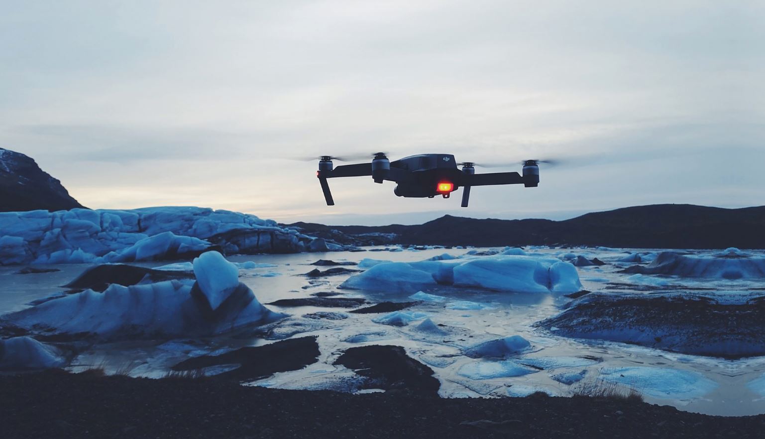
Drone monitoring the level of melting ice.
Genuine vigilance for our environment
Drones have become an indispensable ally in protecting the environment. They can provide precise information on the state of natural environments, detect traces of pollution, protect both terrestrial and marine animals and control vegetation. They can also be used to control air quality or detect gas leaks. The Finnish start-up Aeromon, has made it possible to analyse 70 industrial pollutants and to map air quality. The UAVs thus allow to obtain quality information that guides the authorities when setting up air pollution measures. They are also used today to detect pollution from ships and aquatic pollution more generally.
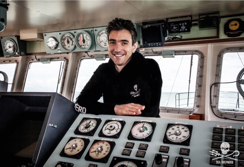
UAVs have the ability to reach isolated or hard-to-reach areas, such as the Arctic, where they monitor ice melt. Elsewhere, they are monitoring coastal erosion and volcanic eruptions. They also venture out into the rainforest or savannah, where they help spot illegal activities, particularly poaching, or identify illegal areas of deforestation. The NGO Sea Shepherd struggles to defend marine ecosystems. It uses drones to spot poachers and illegal nets in order to eliminate them. In the Gulf of California for instance, they are working with the Mexican authorities to protect the world's most endangered cetacean, the vaquita. Interestingly, DroneSeed company has created a drone capable of planting trees thanks to a cannon that propels capsules trapping seeds at more than 380 km/h that sink at a depth of more than 7 centimetres in the ground. This drone has the capacity to plant trees six times faster than a human. This invention makes it possible, in particularly inaccessible areas, to fight against deforestation and zones devastated by forest fires.
The other side of the coin
The advantages associated with UAVs are today considerable and, therefore, their exploitation is exponential. Small, affordable, and easy-to-use; they are simple to procure and their number are increasing. It is predicted that by 2025, more than 25 million UAVs will be in circulation worldwide! As a corollary to their growing popularity, these flying machines are more and more associated with fraudulent acts. Their malicious potential is damaging their reputation and, as a consequence, also becoming synonymous with threats. In France for example, the authorities became aware of the extent of the possible damage. They sounded the alarm when, in 2014, these UAVs flew over 15 nuclear power plants for unknown reasons.
Major risks
But what dangers can drones cause? The ESSE (École Supérieure de la Sécurité des Entreprises) has established a typology of UAV risks. For this French institution, there are three of them: terrorist attack, espionage and smuggling. At the terrorist level, it is not difficult to imagine that an explosive could easily be attached to a drone or that it could be used to guide a suicide vehicle. Daesh has moreover made use of numerous devices capable of filming propaganda documents, carrying out indirect fires and even dropping bombs. In 2018, it was the Venezuelan President Nicolas Maduro who was the victim of a drone attack during a conference in Caracas.
Espionage or surveillance can take different forms: tracking, video recording, conversation listening, data interception. In China, the authorities have set up a system of population control using pigeon drones. These bionic animals are remotely controlled thanks to a high-definition camera and an integrated GPS. Jewels of technology, they imitate up to 90% of the behavior of a real bird. They make it possible to observe everyone's actions in the streets, identify uncivil behaviour and track the population. These pernicious uses of drones make us aware of the risks they can have on individual liberties and privacy. In addition to hyper surveillance, espionage can also take an economic form. UAVs are notably capable of dropping ghost wifi terminals or diverting company email conversations.
Similarly, UAVs allow smuggling operations to be carried out. They are capable of illegally transporting not only smartphones but also weapons and drugs. Between Hong Kong and Shenzhen, drones were discovered carrying bags each containing up to 10 iPhones.
The perception of an increase in the number of accidents should not be overlooked either. One danger concerning UAV is clearly the aviation itself. Near misses (near-collision between an aircraft and a UAV) are on the rise. In 2017, on French territory, 92 of these accidents were recorded. Beyond the health consequences, these accidents also cause significant economic damage. The shutdown of Dubai airport in 2017 due to unauthorised drone activities cost $100,000 per minute. However, these collisions can also occur. In the same year, a plane on a domestic flight in Canada was hit by a drone on its approach to Jean-Lesage airport. The multiplication of UAVs in the air also represents a new threat to people on the ground, as they find themselves in their trajectory and be run over or hit by them in the head. This increase in incidents is also directly associated with the appearance of new gears. Although they could ease traffic and solve certain problems related to traffic jams, the arrival of the futuristic UAV-taxis, designed and manufactured by the German company Lilium, could also make the skies more and more crowded. Another invention that could congest the sky is the new CityAirbus. This flying taxi, automated and completely electric, was designed by Airbus Helicopters. It has the shape of a drone, measures 8 meters long and wide, has a maximum speed of 120 km/h and has an autonomy of 15 minutes. Although the company is still carrying out tests, the objective is to transport up to 4 people at the Paris Olympics in 2024 with the goal of relieving road traffic congestion. The introduction of these flying taxis, designed by major players in the world of aeronautics, will make it possible to take measures to secure airspace and potential victims on the ground?
The challenge now is to find solutions! Detection, identification and neutralisation. It is necessary to be able to stop them to defend ourselves from their potential offensives.
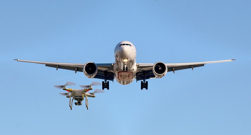
Threat of collision between an aircraft and a drone.
New Regulations
To counter these attacks and limit the threats, some tracking systems have been developed: radar, radio frequency, optical, infrared and acoustic. Other countermeasure tools such as falconry, jamming, spoofing, mobile weaponry and hard kill solutions are also applicable. However, not all these methods are 100% reliable. To control and reduce the risks, new regulations need to be established. A number of expert groups are currently working on this issue, such as JAURUS (Joint Authority for Rulemaking on Unmanned Systems) at international level or the US FAA (Federal Aviation Administration) and, at the European level, the EASA (European Aviation Safety Agency). Faced with the disparity of national framework measures, a European regulation on UAVs has been created: the implementing regulation (EU) 2019/947, and its "Easy Access Rules". The date of implementation of these measures, initially scheduled for July 1st, 2020, has been postponed to December 31st, 2020 due to the health crisis linked to the coronavirus. Since then, the European regulation on UAS is directly applicable in all the member states of the European Union, as well as in Iceland, Liechtenstein, Norway, and Switzerland. These measures are the result of a desire to ensure security and uniformity, which will also make it possible to promote activities in Europe, such as the free trade of UAVs. The pilots can now use their aircraft in any EU country if they have the required certificates. However, they must respect certain national specificities such as the minimum age of the pilot or the areas prohibited from flying.
What changes?
Whether you are a professional or an amateur, from now on you will have to comply with these measures. Firstly, all users will have to register their aircraft with the national aviation authority. The old laws were established according to the type of use of the UAV: commercial or private. Today, Today, these categories have disappeared to make way for a classification based on the following parameters: breaches of security, privacy and the environment. This leads to three categories. The Open category concerns UAVs that present low risks, the flights are always visual and cannot exceed 120 m in altitude. The Specific category refers to those with medium risk exposure. Therefore, the operator requires an authorisation following a risk assessment. Finally, the Certified category is aimed at UAVs with higher risks, the use of the aircraft then requires a triple certification: of the operator, the UAV and the pilot (under license). These new measures will also apply to prohibited or restricted zones for UAVs, such as airports, nuclear sites, military zones, etc. These areas are called "UAS geographical areas", i.e. areas over which drones cannot fly, can only fly under certain conditions, or for which a flight authorization is required.
As an extension of the human hand, these jewels of technology are promising responses to multiple challenges, acting and guiding us in a targeted and calibrated way where we are powerless or vulnerable. True tools of resilience, of course, but these concentrates of technology also prove to be dangerous in several ways, and framing their use is proving to be a real challenge.
-Article published on November 23, 2020-
To be read also in the dossier "Drones" :